
How does adding coordinates to the EXIF data affect local rank? Our team wanted to find out. That’s why we recently conducted a 10-week study on the effects of geotagging for local rank.
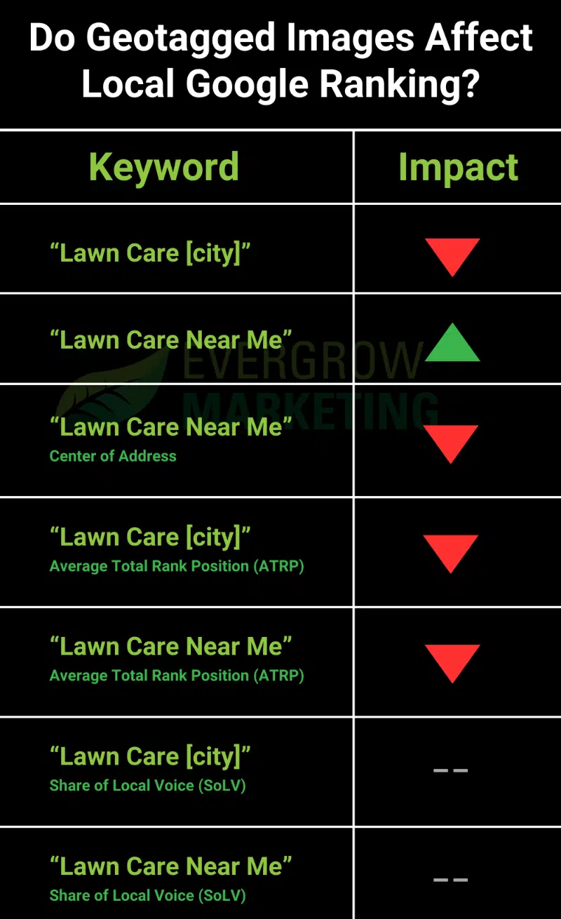
The geotagged images seemed to only affect the ranking for “near me” queries in the areas the EXIF data coordinates specified. Their impact on those queries in those areas was positive and statistically significant.
However, the study also found that queries that mentioned specific towns saw a decrease in ranking during the same period.
In other words, when EXIF data targeted Salt Lake City, Utah, the query [lawn care near me] saw a significant increase in rank.
For the same targeted area, the query for [lawn care salt lake city utah] saw, on average, decreases in rank.
The geotagging debate
SEOs have argued for years about whether adding coordinates to image EXIF data (known as geotagging) affects a business’s Google Business Profiles (GBP) rank.
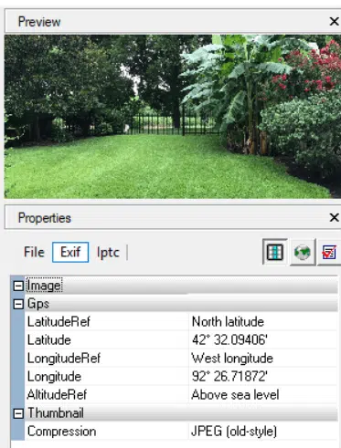
The theory is that if a business owner or customer takes a photo from their phone and uploads it to a GBP, Google reviews the EXIF (metadata) of that image and uses the location of where it was taken as a ranking signal.
Phones automatically use location details to input EXIF data on each photo taken from the device.
It’s speculated that Google uses the EXIF location data before stripping it.
On the surface, it makes sense.
However, skeptics don’t believe Google does this. This is because this data can easily be manipulated using any free EXIF editor.
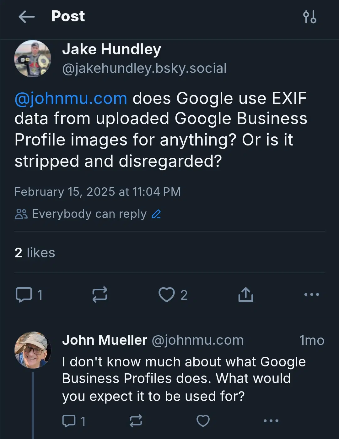
Google’s John Mueller said it was unnecessary for SEO purposes, two years ago on Reddit.
- “No need to geotag images for SEO.”
Mueller also told me he didn’t know much about what GBPs do, in February on Bluesky.
- Joy Hawkins, owner and president of local SEO agency Sterling Sky, performed a test on this in January 2024. She tested five GBP locations and saw no measurable increases over several weeks.
- A month later, consultant Tim Kahlert, CEO of Hypetrix, performed a test. He also concluded that “this tactic currently has no effect on local rankings.”
These tests were better than nothing, but still weren’t enough. Plus, the sample sizes of the locations tested were quite small.
Those who say geotagging works never post their data or case studies, only offering anecdotal evidence.
Geotaggers aren’t publishing their tests and skeptics aren’t conducting them at scale. Google flip-flopping on their position doesn’t help either.
It was time this test was done justice.
Methodology and testing
Our test included 27 of our lawn care business clients. All SEO efforts were paused for the sole purpose of this test.
Every week on Tuesday and Thursday, we would post a client-owned image to their GBP (two images per week).
We then selected two towns in their service area grid that needed improvement. We based these on a baseline report taken from Local Falcon at the beginning of the test period. We kept these towns moderately far apart to avoid any kind of bleedover.
In this example, we might have selected “Little Falls” and “Garrisonville.”

During the test period, coordinates would be added to the EXIF data of the images. On Tuesday’s image, we’d add the center of Little Falls. On Thursday’s image, we’d add the center of Garrisonville.
We ran a report, monitored position changes, and charted them, every week
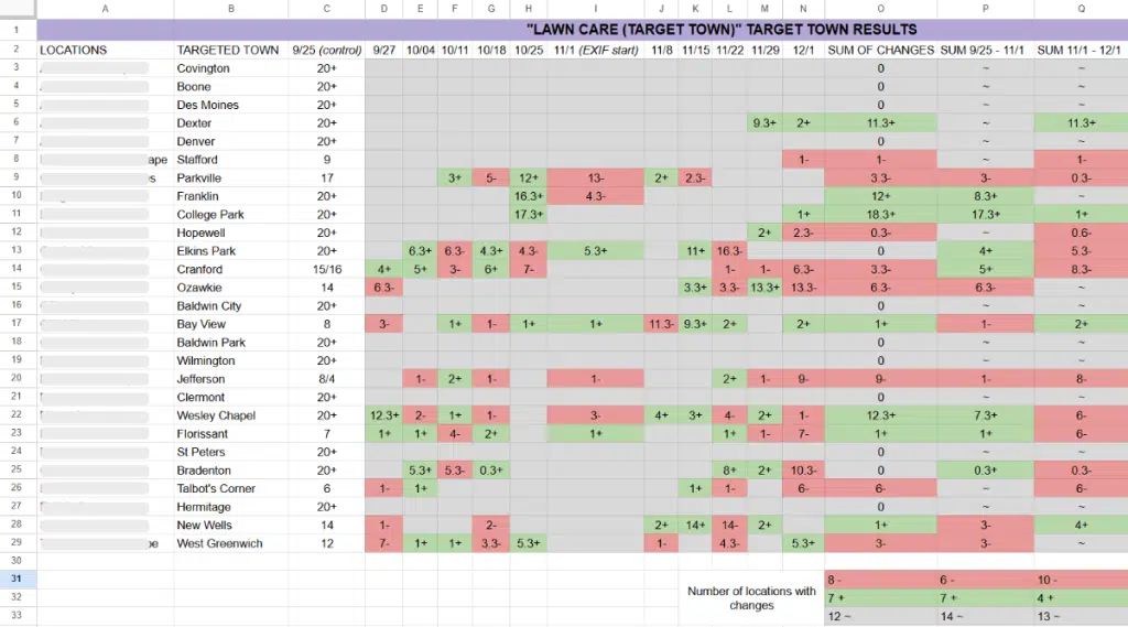
For each location, we tracked three keywords. Following the example above, we tracked:
- “Lawn care garrisonville”
- “Lawn care little falls”
- “Lawn care near me”
For [lawn care near me] we monitored how it affected position changes in both of the target towns.
The control period
Establishing a proper control period was crucial.
The control period had to run for the same duration as the test period (five weeks). To establish consistency and isolate variables, we:
- Maintained the image posting schedule. This ensured adding images on different days didn’t influence rank.
- Stripped all EXIF data to ensure the only variables in the test period were the coordinates.
- Monitored the same keywords to set a baseline.
- Paused all SEO efforts for all 27 locations.
We continued as normal when the control period ended. The only change was adding town #1’s coordinates to Tuesday’s image and town #2’s coordinates to Thursday’s image.
Findings
Most of what we found validated the skeptics’ statements. But that doesn’t mean we ignored the geotaggers.
Service + city
In our example, when images were geotagged with their coordinates, both Garrisonville and Little Falls saw decreases in rank for “lawn care garrisonville” and “lawn care little falls.”
The conclusion? Geotagging had no impact whatsoever.
Service + near me
This one surprised me – and it had statistical significance. Garrisonville and Little Falls saw an overall increase in rank for [lawn care near me] queries.
Service + near me (CoA)
Local Falcon also produces reports on Center of Business Address. This monitors the rank of your target keywords where the business pin is actually located.
The end result: EXIF data had no effect on the business’s actual location for “near me” queries. Ranking dropped a lot more when EXIF data was added to the images targeting different areas.
Service + city (ATRP)
Average Total Rank Position is the average position in the target area. This is seen if only adding images targeting those two areas affects the rest of the service area.
The end result: There was no impact. When EXIF data was added for the full-service areas, the average rank of those areas decreased further.
Service + near me (ATRP)
The “near me” queries for ATRP yielded the same result as above.
No impact, yet rankings plummeted further with geotagging.
Service + city (SoLV)
Share of Local Voice is another metric Local Falcon tracks. It shows how often a location shows in the top 3 positions of the map pack for the target queries.
The results started to deviate from Center of Address and ATRP reports. However, not by much.
The final result was that geotagged images had no impact. However, this time, the ranking didn’t continue to plummet during the test period.
Service + near me (SoLV)
We had the same results with “near me” queries on both images as we did with the [service] + [city] queries.
Geotagged images had no impact here.
Final thoughts
Out of the seven metrics we looked at:
- Only one saw an improvement.
- Six had no impact.
- Of those six, four of them saw a decrease in rank when images were geotagged
The last five metrics focused on the service area as a whole, not the specific areas where the EXIF data was pointing.
I can draw one main conclusion from this:
Although it helps the “near me” queries in those targeted areas, it hurts everywhere you don’t add geotagged images.
The solution?
Upload tons of images to every town in the area to combat that. But you’re going to run into two problems if you do this:
- Your GBP will be spammed with low-quality images for the sake of adding images. Wouldn’t it be better to just make sure the GBP is using good photos? Adding images for the sake of rank diminishes the user-facing quality.
- You’re still losing rank for queries that use the target city in the keyword. It’s a trade-off that only looks at one version of a search term. The other version appears to have negative consequences.
For these reasons, our agency won’t geotag our clients’ GBP images. Instead, we’ll focus on things that have a greater impact on local rank.
Contributing authors are invited to create content for Search Engine Land and are chosen for their expertise and contribution to the search community. Our contributors work under the oversight of the editorial staff and contributions are checked for quality and relevance to our readers. The opinions they express are their own.